As part of a Federal Emergency Management Agency (FEMA) project to modernize the nation’s flood zone maps, the South Florida Water Management District (SFWMD) worked to obtain FEMA accreditation of the Broward County portion of the East Coast Protective Levee (ECPL).
The ECPL separates western communities in Broward, Miami-Dade and Palm Beach counties from the Everglades Water Conservation Areas. Flood zone maps are used to determine flood insurance purchase requirements and rates, and establish minimum floor elevations for new construction and substantial improvements to existing structures. A levee that does not meet FEMA standards could result in an expansion of areas in Broward County considered susceptible to flooding.
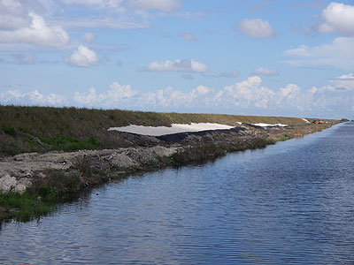
The levee was originally constructed by the U.S. Army Corps of Engineers (USACE) in the early 1950s. Ownership was transferred to the SFWMD, who has maintained the levee for the past 60 years. The levee is recognized on current FEMA flood zone maps as an accredited levee.
What is the ECPL?
The ECPL stretches for more than 100 miles from the Homestead area north to the eastern shore of Lake Okeechobee. The Broward portion of the ECPL is 38.3 miles, and touches a small portion of unincorporated Broward County and portions of eight municipalities, including: Parkland, Coral Springs, Tamarac, Sunrise, Weston, Southwest Ranches, Pembroke Pines and Miramar. As part of the accreditation process, SFWMD engineers provided FEMA with documentation that demonstrated compliance with FEMA standards regarding the condition of the levee.